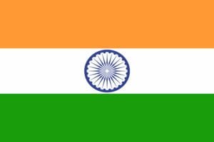
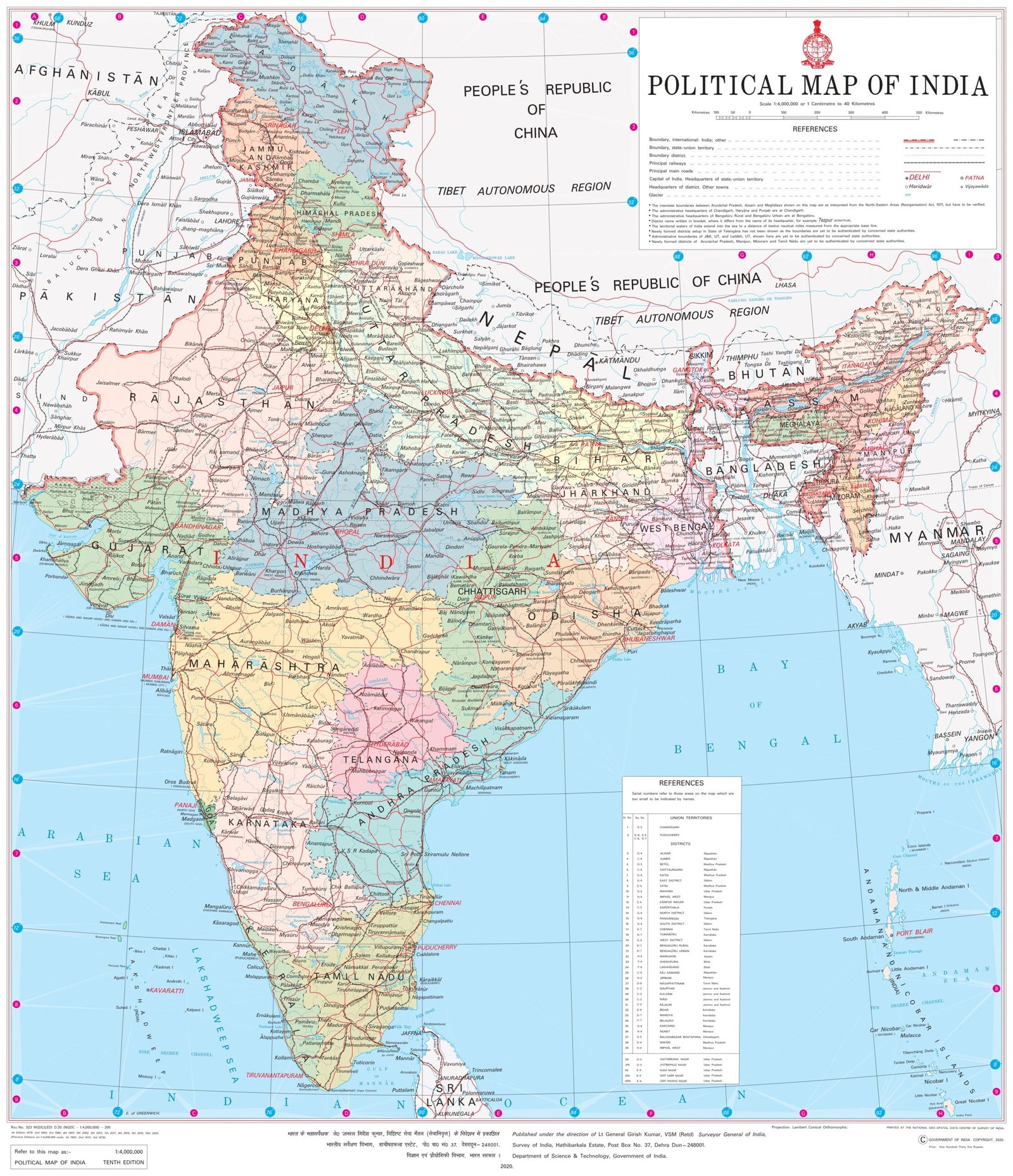
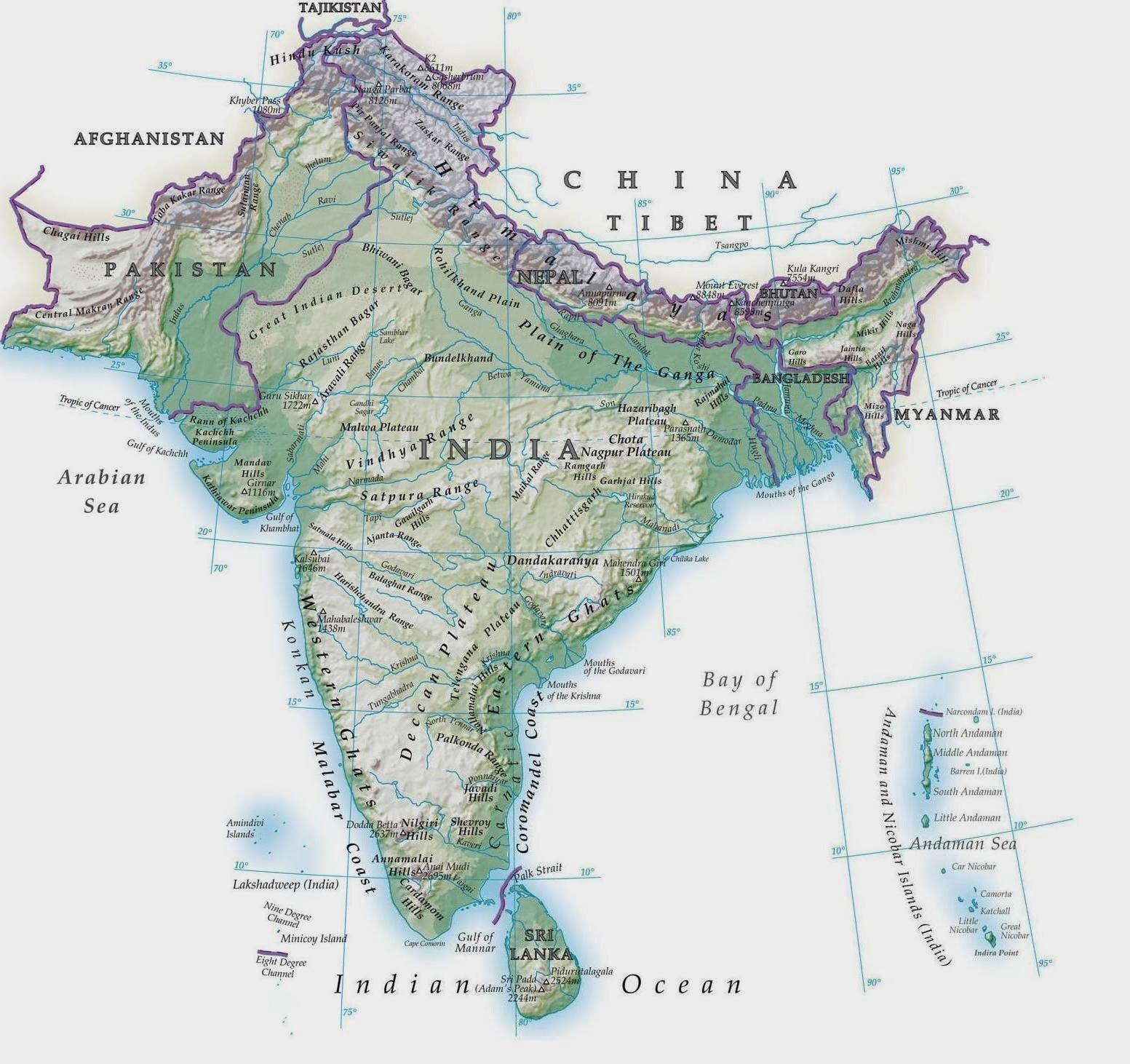
INDIA (BHARAT)

CAPITAL OF INDIA:- NEW DELHI

INDIAN NATIONAL FLAG

About Indian National Flag

Indian National Flag is also known as “Tiranga”. It consist of three colours which represent different aspects of the country like, ‘Safforn’ represents the ‘Bravery’, ‘White’ represents ‘Peace’ that India promotes and ‘Green’ represents the ‘Greenery’  that country have. The “Ashoka Chakra” which has 24 wheels and it says about constant development of the country.

India's State Emblem
STATE EMBLEM:-

The state emblem is an adaptation from the Sarnath Lion Capital of Ashoka. In the original, there are four lions, standing back to back, mounted on an abacus with a frieze carrying sculptures in high relief of an elephant, a galloping horse, a bull and a lion separated by intervening wheels over a bell-shaped lotus. Carved out of a single block of polished sandstone, the Capital is crowned by the Wheel of the Law (Dharma Chakra).

Political Map Of India ( Source- Survey Of India )
About India:-

India is present in South Assia and capital of India is “Delhi”. India is the seventh largest country in world with area of 32,87,263 sq. km and vast population of 1.2 billion people, with “Uttar Pradesh” having highest population with 19,98,12,341 people and “Sikkim” having least population with 6,07,688 people (according to census 2011). India has population density of 382 per sq. Km and sex ration 943 females per 1000 males. India has the literacy rate of 74.04%, with “Kerela” having highest 93.91% and “Bihar” with lowest 63.82%(Census 2011). The country have 28 states and 8 Union Territories. India also has 766 Districts and 102 Divisions (As of September 2022).

India’s Neighbour :-

India share it’s borders with China in the North and North-east, Pakistan in North-West, Bangladesh and Myanmar in the East, Afghanistan in the North ,Bhutan and Nepal in North-East.

STATES:-

Union Territories:-

Andaman and Nicobar Island Dada Nagar Haveli & Daman & Diu Jammu & Kashmir Lakshadweep
Chandigarh The Government of NCT of Delhi Ladakh Puducherry

Physical India:-

Physical Map Of India
Physical India:-

India is very diverse in terms of geography with Himalayas in the North is longest Mountain Range in the world with the length of  is about 2500 km. Indian Ocean in the south and Thar Desert in the West(Rajasthan) with the Area of about 2,00,000 Sq. km. India three side is covered with ocean i.e., Arabian sea, Bay of Bengal and Indian Ocean. Bay Of Bengal is the largest Bay in the World with area of about 21,72,000 Sq. km. In North, with Himalaya the highest peak is “Mt. Kangchenjunga”(In India) with height of “8,586 meters“. In India and Tallest mountain in the World is also in the Himalayas is “Mt. Everest” with the height of  “8,848.86 Meters“. The Tropic of Cancer passes through ‘8 states’ i.e., Gujarat, Rajasthan, Madhya Pradesh, Chhattisgarh, Jharkhand, West Bengal, Tripura and Mizoram. India’s Largest Plateau i.e. “Deccan Plateau” lies between Eastern Ghat and Western Ghat. It has an elevation between 100m to 1,000m with and average elevation of 600m. 
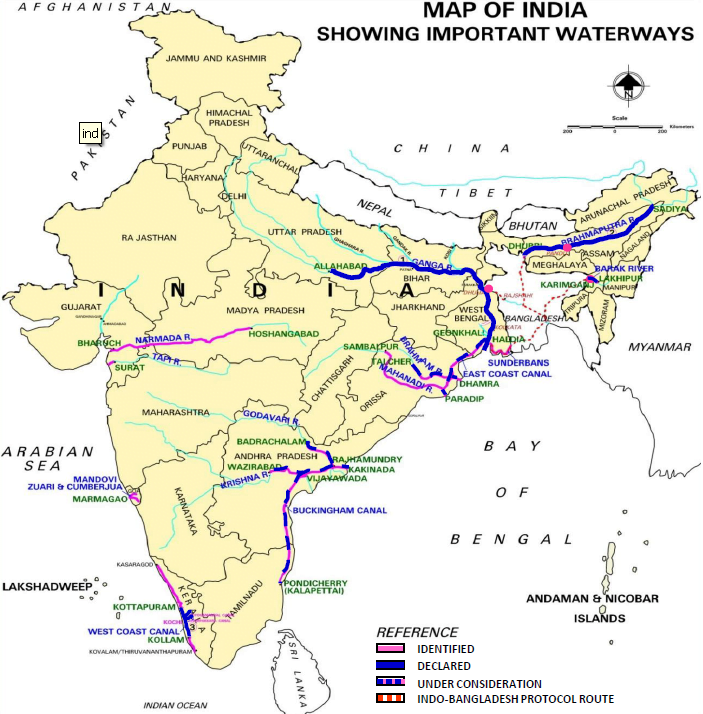
Rivers:-

In India, There are four types of Rivers:-

(i). Himalayan River:- These River originates from the melting of glaciers in  Himalaya therefore, they flow for entire year and Himalaya also receive heavy in rainfall in rainy season, this causes in frequent floods in these rivers. These rivers mainly drain in the ocean like “Ganga’ drains in ‘ Bay of Bengal’ and “Indus river” drains in Arabian sea.

(ii). Deccan Rivers:- Deccan Rivers originates through rain so the volume mostly depends on amount of rainfall. Deccan Rivers mostly are east flowing rivers one of the many examples are Godavari, Which is second largest river basin covering almost 10 percent of the area of the India , it drains in Bay of Bengal.

(iii). Coastal River:- There are numerous coastal rivers, which are comparatively small. While only handful of such rivers drain into the sea near the delta of east cost, there are as many as 600 such rivers on the west coast.

(iv). Rivers of the Inland Drainage Basin :- These rivers do not drain into sea like, A few rivers in Rajasthan do not drain into the sea. They drain into salt lakes and get lost in sand with no outlet to sea. Besides these, there are the Desert Rivers which flow for some distance and are lost in the desert. These are Luni and others such as, Machhu, Rupen, Saraswati, Banas, Ghaggar and others. 

List Of The Some Major Rivers:-

S.I. NO. Rivers Length
1 Indus 2,900 Km
2 Brahmaputra 2,900 Km
3 Ganga 2,510 Km
4 Godavari 1,450 km
5 Narmada 1,290 km
6 Krishna 1,290 km
7 Mahanadi 890 km
8 Kaveri 760 km

INDIAN Maps For Public Transports:-

Indian Highways
Indian Railways (Source :- Survey of India)
Indian Waterways
Indian Transport:-

In India, People mainly travel through public transport, so India has very diverse and sophisticated transport network. These transport network are :-

(i). Indian Roadways :- India has the second largest Road Network in the World with the length of 67 lakh kilometers just behind U.S.A. who is with 68.32 lakh kilometer. India’s road construction is 29 km per day. India also holds world record in road  construction of 25 km long bitumen Solapur-Bijapur road within 24 hour. India has the road density of 204 km per 100 sq. km. 

(ii). Indian Railways :- Indian Railways is Fourth largest railway network in the world with 68,043 km, behind U.S.A. with 2,50,000 km , China with 1,00,000 km and Russia with 85,000 km. Indian Railway has electrified the railway network by 59,524 km. Indian Railway employees 1.3 million people by becoming eighth largest employer. Indian Railway has future plan of doubling the length, total electrification, Dedicated Freight Corridor by 2030.

(iii). Indian Waterways:- India is sixth largest waterways in the world with 20,275 km(by 2016) behind Russia with 3,17,505 km, Brazil with153,348 km , China with 1,38,357 km, United States with 40,230 km, Indonesia with 21,275 km. As per 2023, India has only 111 National waterways identified under National Waterways Act,2016. 

Facebook
Twitter

Leave a Reply

Your email address will not be published. Required fields are marked *


The reCAPTCHA verification period has expired. Please reload the page.

Scroll to Top