
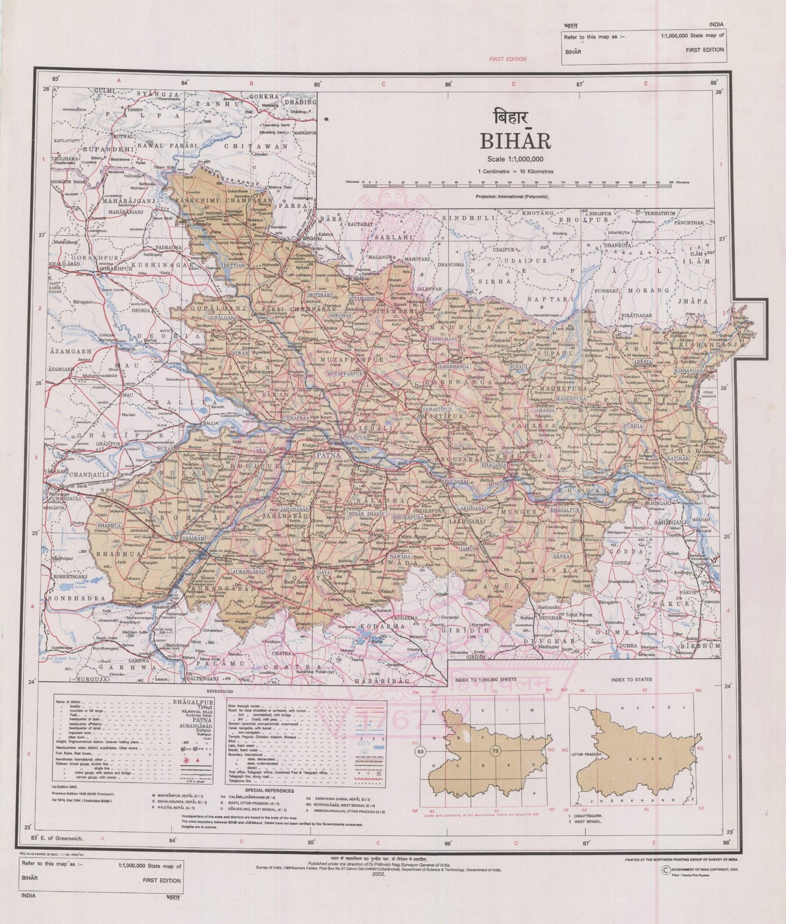
BIHAR
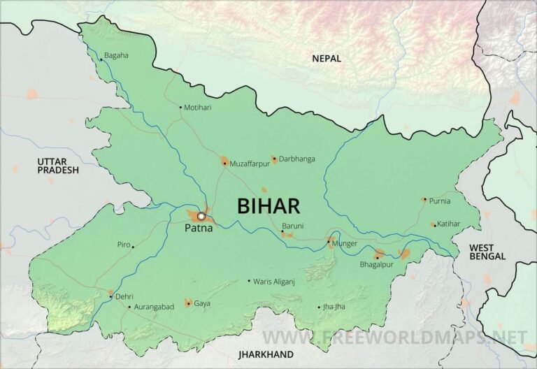
CAPITAL:- PATNA
About Bihar:-
Bihar the birth place of Great People like, Aryabhata, Guru Gobind Singh (6th Guru of Sikhs) and India’s most densely populated State located in East Zone of India. On 22 March, 1912 Bihar was formed and it plays major role in India’s Nationalist movement. Today, It has the total population of 10,40,99,452 with the Rural population of 9,23,46,624 and the Urban Population of 1,17,52,828 with the density of 1,106 per sq. km. The Male population in Bihar is 5,42,78,157 and the Female population is 4,98,21,295 with the Sex Ratio of 918 Females per 1000 Males. It has the Total of 38 district and the Literacy Rate of 61.80% (ACCORDING TO CENSUS 2011)
Geography Of Bihar:-
Geography Of Bihar:-
Bhar is a state Located in East Zone of India with the total Area of 94,163 Sq. km with the Rural Area of 92,257.51 Sq. km and Urban Area of 1,095 Sq. km. This landlocked state of Bihar is surrounded by Nepal, Bengal, Orissa, Madhya Pradesh, Uttar Pradesh and comprises four cultural regions-Bhojpur, Mithila and Magadha and Chotanagpur. Bihar also has the forest area of about 6,764 Sq. km.
Rivers:-
There are multiple Rivers in Bihar and it is said that Bihar has one of the most fertile Land in India due to it’s persence in Indo-Gangetic Plain. Rivers Kosi and Gandak from the north and Sone from the south join the Ganga. In the fertile plains, rice, sugarcane, oilseeds, gram, maize, jute, barley and wheat are cultivated.
The list of Some of the Major Rivers in Bihar are:–
- Ajay River
- Bagmati
- Budhi Gandak
- Bhutahi Balan
- Gandak
- Ganges
- Ghaghara
- Phalgu
- Gandaki River
- Kamala
- Karmanasha
- Koshi River
- Mahananda River
- Mohana
- Punpun
- Sapt Koshi
- Son River
DISTRICTS OF BIHAR(With Official Links):-
States:-
Union Territories:-
| Andaman and Nicobar Island | Dada Nagar Haveli & Daman & Diu | Jammu & Kashmir | Lakshadweep |
| Chandigarh | The Government of NCT of Delhi | Ladakh | Puducherry |