
KERALA
CAPITAL:- THIRUVANANTHPURAM
About Kerala:-
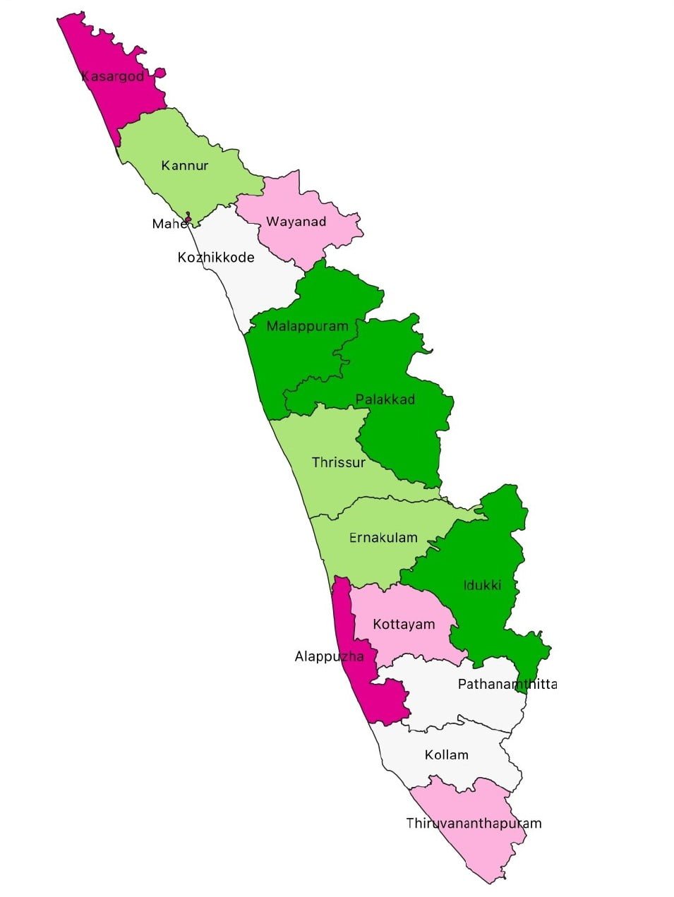
Kerala, the state with highest in Sex-Ratio, Life Expectancy and Literacy Rate and also home to the world’s richest temple “Padmanabhaswamy Temple” with total worth of “18 billion dollars.” Kerala is 12th Largest State in the India in terms of population with total population of 3,34,06,061. The state has the Rural population of 1,74,71,370 and Urban population of 1,60,27,412 with the Density of 860 per Sq. km. Kerala has the Male Population of 1,60,27,412 and the Female Population of 1,73,78,649 with the Sex-Ratio of 1084 Females per 1000 Males. The state has the total of 14 Districts and the highest Literacy rate among all the state i.e., 94.00%. (DATA ACCORDING TO THE CENSUS 2011)
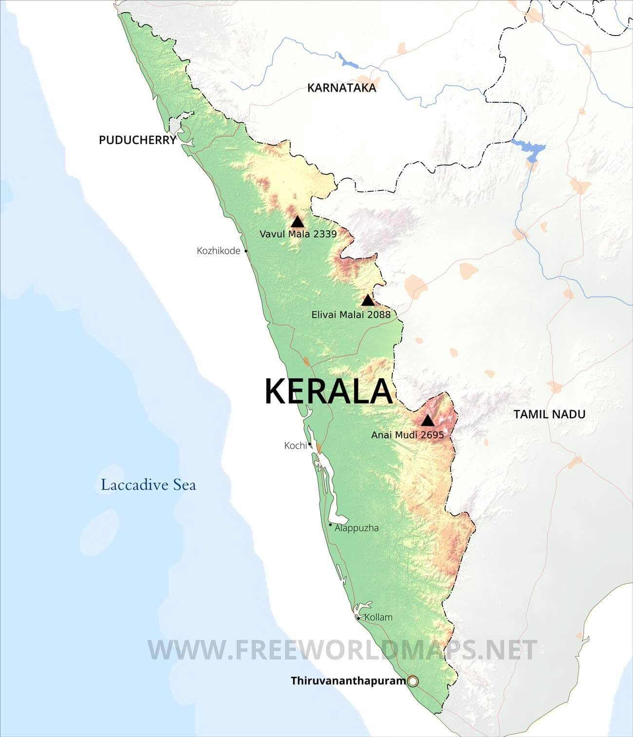
Physical Map of Kerala:-
Geography of Kerala:-
The world Kerala means “Land of Coconut” and the state which receives the first rainfall in the country is present in the Southern Part of the Country. Kerala is the 21st Largest state in terms of total Land area of 38,863 Sq. km. Kerala shares it’s borders with two states that are, Karnataka, Tamil Nadu and a Union Territory of Puducherry and has a coastline to the Arabian sea with the length of 590 km.
Kerala can be divided into 3 Geographical regions.
1) Highlands
2) Midlands
3)Low Lands .
The High lands slope down from the Western Ghats which rise to an average height of 900 m, with a number of peaks well over 1,800 m in height. This is the area of major plantations like tea, coffee, rubber, cardamom etc.
The midlands lying between the mountains and the lowlands, is made up of undulating hills and valleys. This is an area of intensive cultivations. Cashew, coconut, areca nut, cassava (tapioca), banana, rice, ginger, pepper, sugar-cane and vegetables of different varieties are grown in this area.
The lowlands or the coastal area, which is made up of the river deltas, backwaters and shore of Arabian sea, is essentially a land of coconuts and rice., Fisheries and coir industry constitute the major industries of this area.
Kerala is a land of rivers and backwaters., Forty-four rivers(41 west-flowing and 3 east-flowing) cut across Kerala with their innumerable tributaries and branches but these rivers are comparatively small and being entirely monsoon fed, practically turn into rivulets in summer, especially in the upper areas.
The Western Ghats constitute the range of hills running almost parallel ot Arabian Sea through Kerala, Tamil Nadu, Karanataka, Goa, and Maharashtra. Of the total length of about 1800 km., approximately 450 km falls in Kerala, ith a break at Palaghat. The western ghats region of Kerala covering nearly 21856 sq km or 56% of the total geographical area of the State and 42.7% of the entire Western Ghats region is the watershed of all the 44 rivers that sustain the agro-economy of the state.
(Source:- KeralaForestDepartment)
Rivers Flow in Kerala:-
West Flowing Rivers:-
- Periyar River
- Bharatapuzha River
- Pamba River
- Chaliyar River
- Chalakudy River
- Kadalundy River
- Achankoil River
- Kallada River
- Muvattupuzha River
- Valapattanam River
- Chandragiri River
- Manimala River
- Vamanapuram River
- Kuppam River
- Meenachil River
- Kuttiyadi River
- Karamana River
- Shiriya River
- Kariangode River
- Ithikkara River
- Neyyar River
- Mahe River
- Keecheri River
- Perumba River
- Uppala River
- Karuvannur River
- Anjarakandy River
- Tirur River
- Neeleshwaram River
- Pallikkal River
- Kallayi River
- Korapuzha River
- Mogral River
- Kavvayi River
- Thanikkudam River
- Thalassery River
- Mamam rivers
- Chithari River
- Ramapuram River
- Ayiroor River
- Manjeswaram River
East Flowing Rivers:-
- Kabani
- Bhavani
- Pambar
(Source:- https://en.wikipedia.org/wiki/List_of_rivers_of_Kerala )
DISTRICTS (With Official Links):-
States:-
Union Territories:-
| Andaman and Nicobar Island | Dada Nagar Haveli & Daman & Diu | Jammu & Kashmir | Lakshadweep |
| Chandigarh | The Government of NCT of Delhi | Ladakh | Puducherry |