
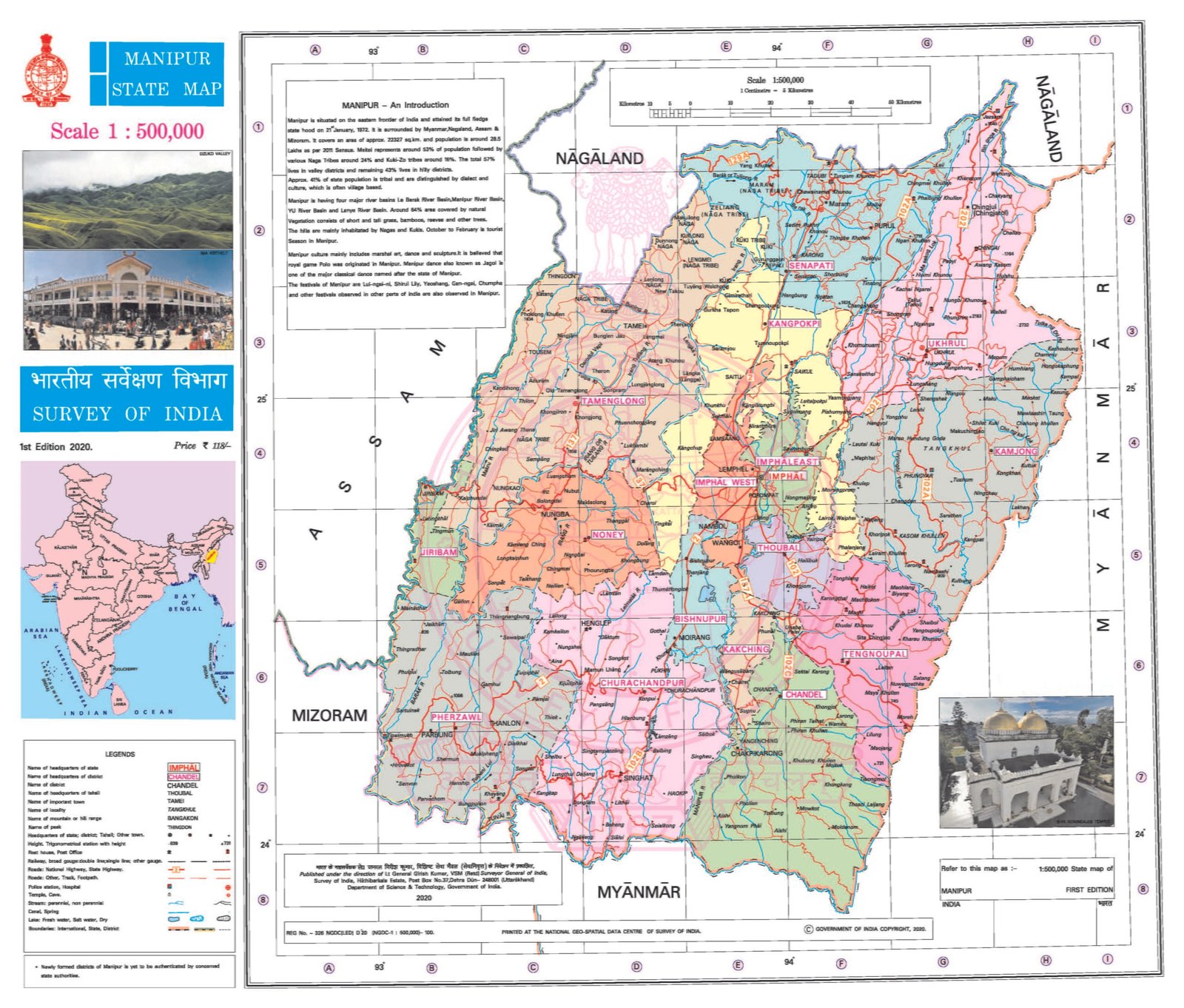
MANIPUR
CAPITAL:- IMPHAL
About Manipur:-
Manipur, which has the only floating National Park “Keibul Lamjao National Park” in the World and also has the World’s Oldest Polo Ground at ” Imphal’s Mapal Kangjeibung” that dates back to 33 AD. Manipur attained his statehood on 21st January 1972 Under the Act North- East Area (Re-organization) Act 1971, before that Manipur was a Union Territory under States’ Re- Organization Act 1956 and Constitution (Seventh Amendment) Act 1956. Manipur is 24th Largest state in terms of population with total population of 28,55,794. The State has the rural population of 20,21,617 and Urban Population of 8,34,177 with the population density of 28 per Sq. km. Manipur has the Male population of 14,38,586 and the Female population of 14,17,208 with the Sex-Ratio of 985 Females per 1000 Males. Manipur has 3 Revenue Divisions and 16 District with the Literacy Rate of 76.4%.
Physical Map of Manipur:-
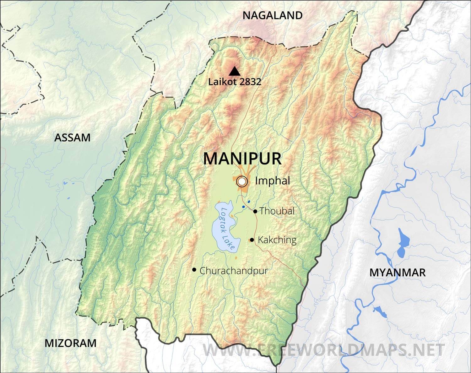
Geography of Manipur:-
Manipur, is located in North-East part of India as one of the “Seven Sisters” with the many pet names as “Kangleipak” and “Meeteileipak” by the local’s. Manipur is the 23rd Largest State in India in terms of Area with the Total Area of 22,327 per Sq. km. Manipur shares its borders with many states like, Nagaland, Mizoram and Assam with the country of Myanmar. The official and most widely spoken language is Meitei language also officially known as Manipuri language.
The altitude ranges from 40 m at Jiribam to 2,994 m at Mount Tempü peak along the border with Nagaland as Mount Tempu is highest Peak. The valley region has hills and mounds rising above the flat surface. The Loktak Lake is an important feature of the central plain. The total area occupied by all the lakes is about 600 Sq. km.
Some Major Rivers of Manipur:-
- Barak River
- Imphal River
- Iril River
- Khuga River
- Manipur River
- Nambul River
- Surma-Meghna River System
- Tiau River
- Tuivai River
Districts of Manipur (With Official Links):-
STATES:-
UNION TERRITORIES:-
| Andaman and Nicobar Island | Dada Nagar Haveli & Daman & Diu | Jammu & Kashmir | Lakshadweep |
| Chandigarh | The Government of NCT of Delhi | Ladakh | Puducherry |