
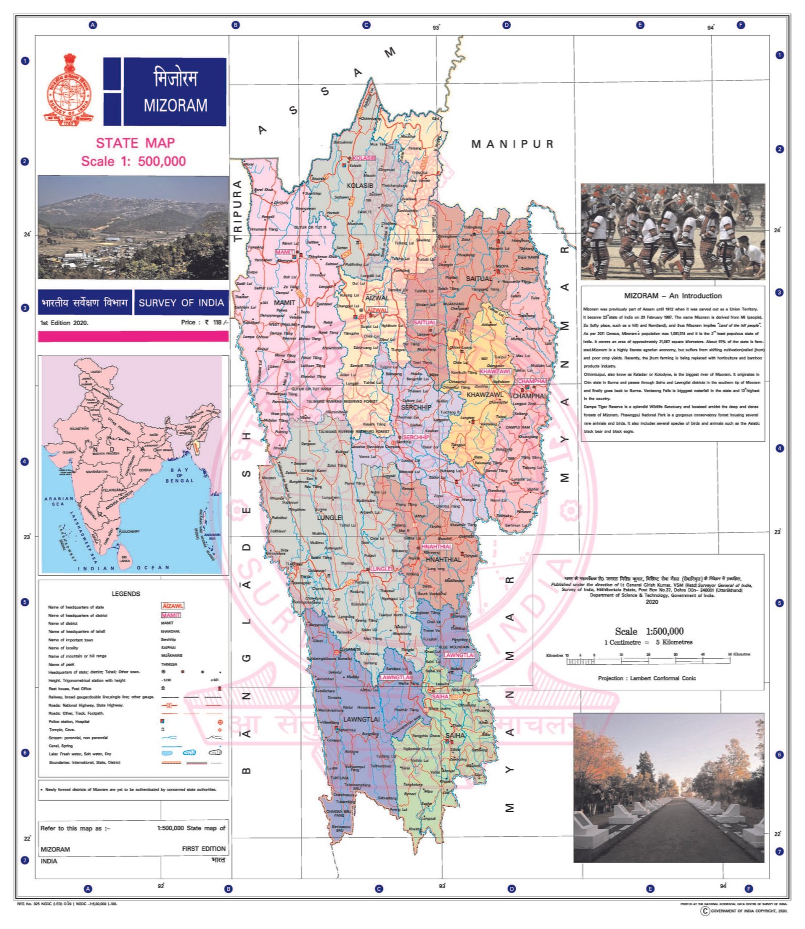
MIZORAM
CAPITAL:- AIZAWL
About Mizoram:-
Mizoram, also known as “Land of the Hill People” and the word Mizoram is the whole meaning of as Mi (individuals), Zo (lofty place) and Ram (land). Mizoram was integrated in India by Britishers in 1895 but Mizoram is got his statehood on 20th February, 1987 by Government of India. Mizoram is the second most least populated state with the total population of 10,97,206. The state has the Urban Population of 5,71,754 and the Rural Population of 5,25,452 with the Total Density of 52 per Sq. km. It has the Male population of 5,55,339 and the Female population of 5,41,867 with the Sex Ratio of 976 Females per 1000 Males. Mizoram has 11 Districts and the total Literacy Rate is 91.33%. (DATA ACCORDING TO CENSUS 2011)
Physical Map of India:-
Geography of Mizoram:-
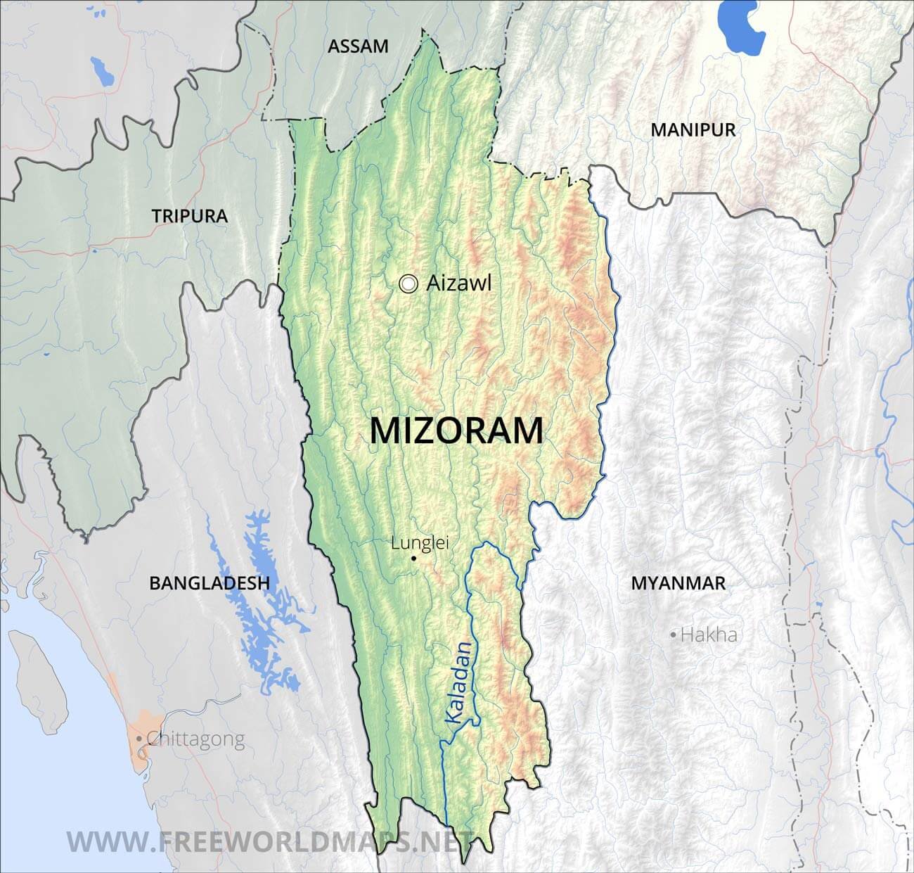
Mizoram situated in North-East Part of India and also the part of “Seven Sisters”. The Tropic of Cancer passes through Mizoram nearly at its middle and a stone was fabricated at a village in the Aizawl district called. “Maubuang Lungsai” and it also has the multiple caves like, Puk Zing “Largest Cave in Mizoram” or Milu Puk etc. Mizoram is the 24th Largest State in terms of Land Area with the total Area of 21,081 Sq. km. Mizoram is the landlocked-state with the many states as the neighbour like, Tripura, Assam, Manipur and it also shares its border with the country of Bangladesh and Myanmar.
Mizoram is a land of hills, valleys, rivers and lakes. As many as 21 major hill ranges or peaks of different heights run through the length and breadth of the state, with plains sprinkled here and there. The average height of the peaks to the west of the state is about 1,000 metres (3,300 ft). If we go to the East these peaks gradually rise up to 1,300 metres (4,300 ft) . However, some areas have higher ranges which go up to a height of over 2,000 metres (6,600 ft). “Phawngpui Tiang” is the highest peak in the state, with the height of 2,210 metres (7,250 ft).
Major Rivers of Mizoram:-
- Tlawng River
- Tiau River
- Chhimtuipui (Koladyne) River
- Khawthlangtuipui (R.Karnaphuli) River
- Tuichang River
- Tuirial River
- Tuichawng River
- Mat River
- Tuipui River
- Tuivawi River
- Teirei River
- Tuirini River
- Serlui River
District of Mizoram (With Official Links):-
STATES:-
UNION TERRITORIES:-
| Andaman and Nicobar Island | Dada Nagar Haveli & Daman & Diu | Jammu & Kashmir | Lakshadweep |
| Chandigarh | The Government of NCT of Delhi | Ladakh | Puducherry |