
NAGALAND
CAPITAL:-KOHIMA
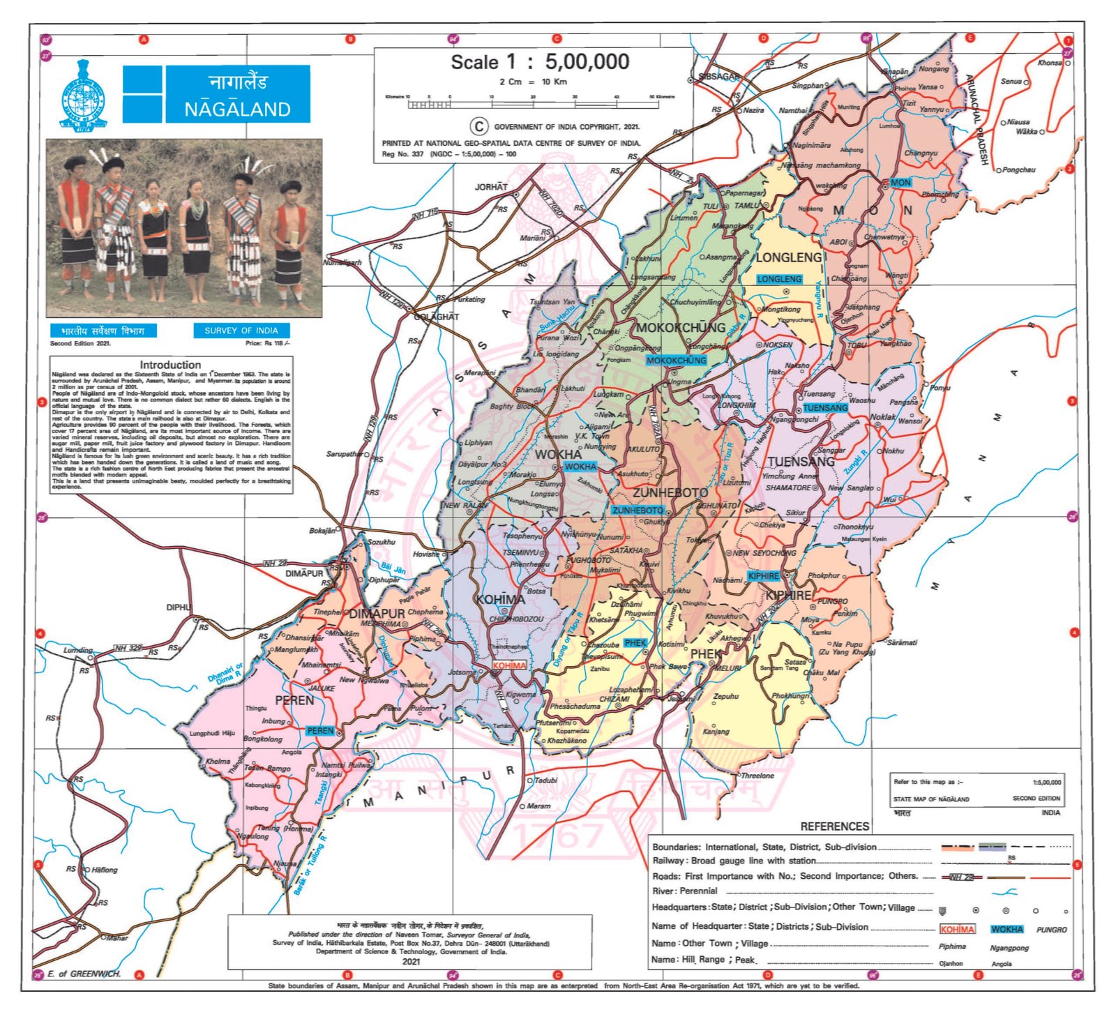
About Nagaland:-
Nagaland, the “Falcon Capital of the World” and home to the one of the Largest Church in Asia “Sumi Baptist Church in Zunheboto” with the sitting capacity of 8,000 people. The State of Nagaland was established on 1st December, 1963 as the 16th State of the country. Nagaland is the 24th largest State in terms of population with the total population of 19,78,502. It is the only State with the population decline with 0.47% from 2001 to 2011. The state has the Rural Population of 14,07,506 and the Urban Population of 5,70,996 with the population density of 119 per Sq. km. It has the Male population of 10,24,649 and the Female population of 9,53,853 with the Sex-Ratio of 931 Females per 1000 Males. Nagaland has the total of 16 Districts and the Literacy Rate of 79.55%. (DATA ACCORDING TO CENSUS 2011)
Physical Map of Nagaland:-
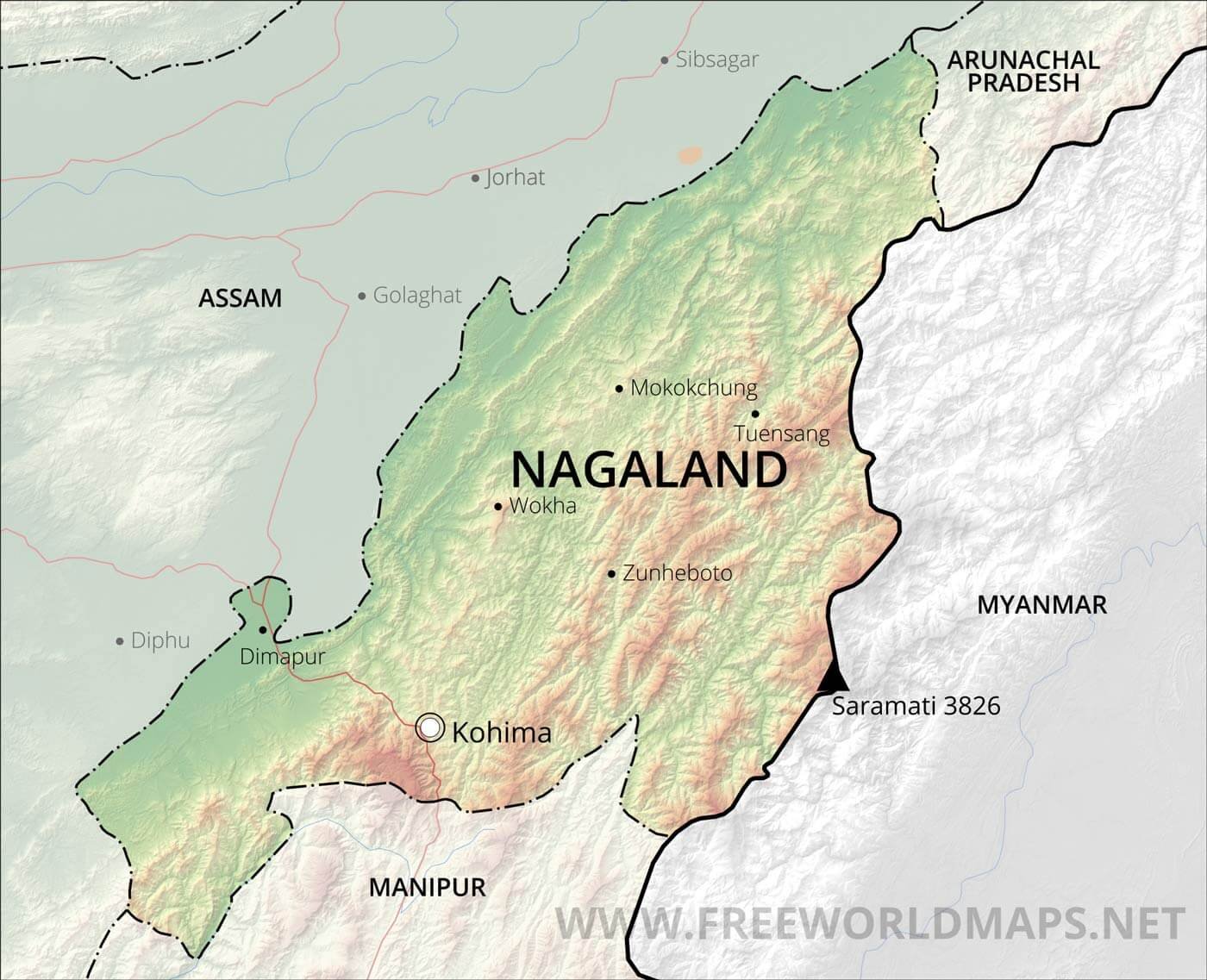
Geography of Nagaland:-
Nagaland, is the state with English its official Language and one-sixth of the Nagaland is covered with tropical and sub-tropical forest. The State is located in the North-Eastern Part of India also known as “Seven Sisters”. Nagaland is the 25th Largest state in terms of Land Area with the total Area of 16,579 Sq. km. It shares its borders with the state of Manipur, Assam, Arunachal Pradesh and the Country of Myanmar.
Nagaland, is mainly a mountain state with Naga Hills and Pataki Range. Naga Hills rises from the Brahmaputra Valley in Assam with 610 metres (2,000 ft) and it further rises in southeast with the elevation of 1,800 metres (6,000 ft). Mt. Saramati is the highest peak in the state with the elevation of 3,841 metres (12,602 ft). Naga Hills merges with Patkai Range to form the natural border with Myanmar.
Some Major Rivers of Nagaland:-
- Bhogodi River
- Chathe River
- Dhansiri River
- The Tizu River
- Doyang River
- Dikhu River
- Kushiyara River
- Langnyu River
Districts of Nagaland (With Official Links):-
STATES:-
UNION TERRITORIES:-
| Andaman and Nicobar Island | Dada Nagar Haveli & Daman & Diu | Jammu & Kashmir | Lakshadweep |
| Chandigarh | The Government of NCT of Delhi | Ladakh | Puducherry |