
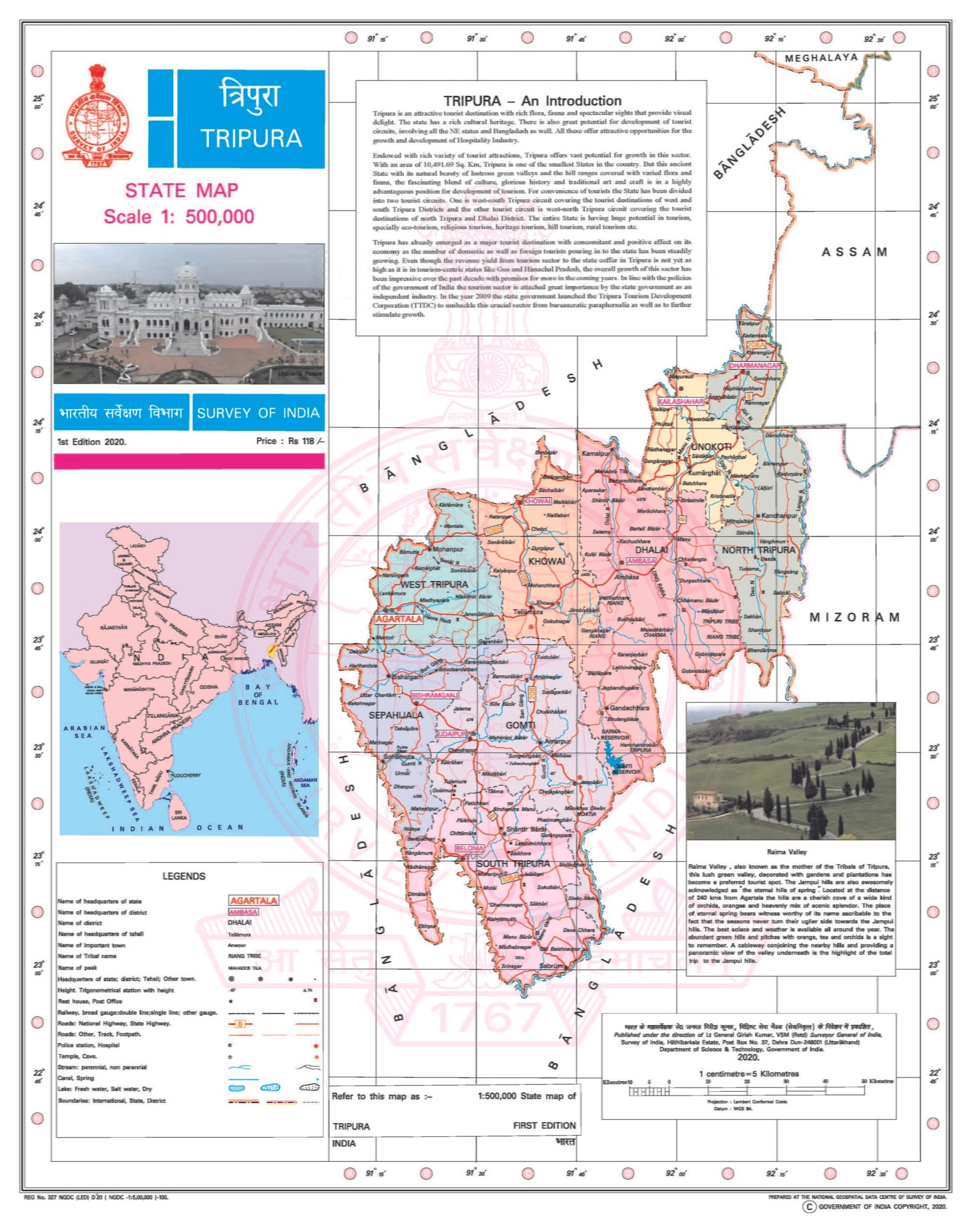
TRIPURA
CAPITAL:-AGARTALA
About Tripura:-
Tripura, name came from “Tipara” tribe to which the ruling kingdom to Tripura belongs. It is a state that is mainly depends on the agriculture, as they mainly cultivate Rice and other cash crops like, Sugarcane, Jute, Tea etc. The state of Tripura attain its statehood on 21st of January, 1972 after being Union Territory from 1st July 1963.
The state of Tripura is 21st Largest state in India in terms of population with the total population of 36,73,917. The state has the Rural Population of 27,12,453 and Urban Population of 9,61,464 with the Density of 350 per Sq. km. It has the Male Population of 18,74,376 and Female Population of 17,99,541 with the Sex Ratio of 960 Females per 1000 Males. The state has the 8 Districts in total and has the Literacy Rate of 87.22%. (DATA ACCORDING TO CENSUS 2011)
Physical Map of Tripura:-
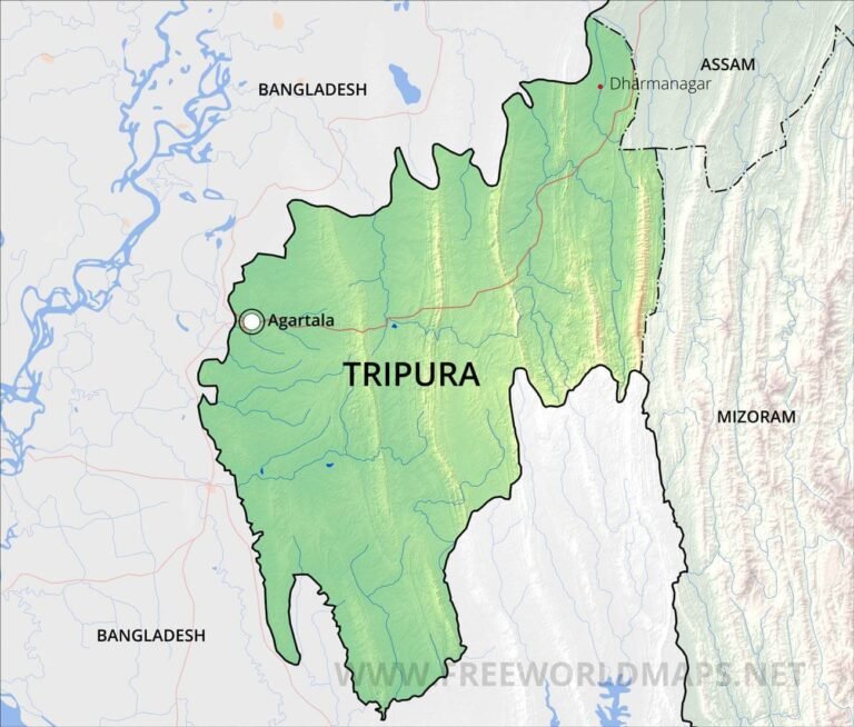
Geography of Tripura:-
Tripura, also known as “Home of Bamboo” because bamboo and their associated crafts found in their day-to-day life and there is only one Road connects Tripura with rest of India and i.e., NH-44. Tripura is the Third smallest state in India in terms of Land Area with the total Area of 10,492 Sq. km. It shares its boundary with the country of “Bangladesh” from three sides and from one side it shares its border with the state of Mizoram and Assam.
The state of Tripura divided into three physiographic zones: i) Hill Ranges, ii) Undulating Plateau and iii) Low-Lying Alluvial Land.
The state has mainly five hill ranges:-
- Jampui Range
- Shakan Range
- Langtarai Range
- Atharamura-Kalajhari Range
- Deotamura and Baramura Range
The general elevation lies between 780 metres in north eastern to 15 metres in in western part. The state has the highest point at “Betalongchhip” which is 975.36 metres tall and lies in “Jampui Range.”
Major Rivers of Tripura:-
- Bijay River
- Deo River
- Dhalai River
- Feni River
- Gumti River
- Haora River
- Juri River
- Khowai River
- Longai River
- Manu River
- Muhuri River
[SOURCE OF RIVERS:- riyabutu.com]
Districts of Tripura (With Official Links):-
STATES:-
UNION TERRITORIES
| Andaman and Nicobar Island | Dada Nagar Haveli & Daman & Diu | Jammu & Kashmir | Lakshadweep |
| Chandigarh | The Government of NCT of Delhi | Ladakh | Puducherry |