
UTTARAKAHND
CAPITAL:-DEHRADUN
About Uttarakhand:-
Uttarakhand, which is also known as ‘Dev Bhoomi’ or “Land of Gods”, because the presence of many temples’ like “Tungnath Temple” which is highest (altitude of 3,680 m) Lord Shiva Temple in world. and also one of the Char Dham’s “Kedarnath”. It is only state with Sanskrit as one of its official language after Hindi. The state was formed on 9th November, 2000 from separation of Uttar Pradesh.
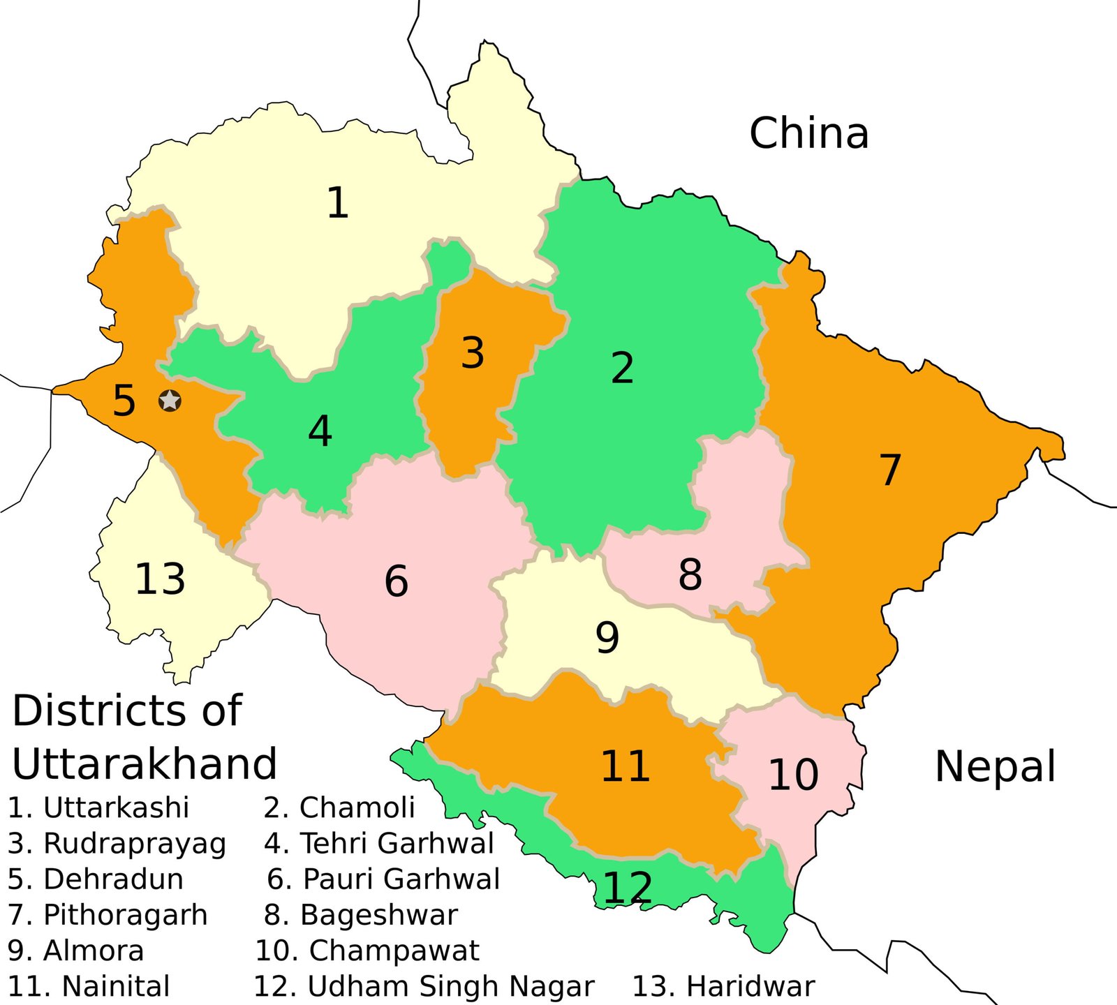
Uttarakhand is 19th Largest State in India in terms of population with the total population of 1,00,86,292. The state has the Rural Population of 70,37,205 and Urban Population of 30,49,086 with the Density of 189 per Sq. km. It has the Male Population of 51,37,773 and the Female Population of 49,48,519 with the Sex-Ratio of 963 Females per 1000 Males. The state has the total of 13 District and the Literacy Rate of 78.82%. (DATA ACCORDING TO CENSUS 2011)
Physical Map of Uttarakhand:-
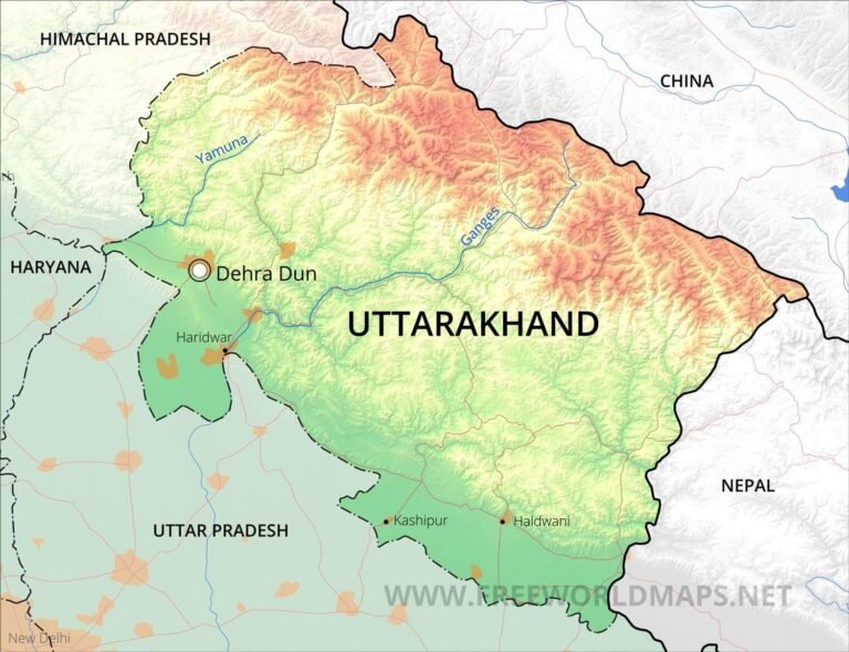
Geography of Uttarakhand:-
Uttarakhand, is state of many natural beauties like a cave with river flowing inside of it “Robber’s cave”, “Nanda Devi” Biosphere which has many rarest species of Flora and Fauna between Zanskar and Himalayan Mountain Range. This state also has the India’s oldest National Park “Jim Corbett national Park” to preserve Bengal Tiger established in 1936. It also has the India’s tallest dams “Tehri Dam” with the height of 260.5 metres.
The state of Uttarakhand is located in Northern Zone of India as India’s 18th Largest state in terms of Land Area of with the Total Area of 53,483 Sq. km. The state shares its border with the states like, Uttar Pradesh, Haryana, Himachal Pradesh and also shares its border with the country like Nepal and China. The state has elevation ranges from 1,000 ft to 10,000 fts (300 to 3,000 metres), with “Nanda Devi” as the highest point in the state with the height of 7,816 metres (25,643 ft). The state has many glaciers and some of them are Gangotri, Yamunotri from where Ganga and Yamuna originates.
Some of the Major rivers are:-
- Ganga River
- Yamuna River
- Alaknanda River
- Bhagirathi River
- Ramganga River
- Kali River
- Tons River
District of Uttarakhand (With Official Links):-
STATES:-
UNION TERRITORIES:-
| Andaman and Nicobar Island | Dada Nagar Haveli & Daman & Diu | Jammu & Kashmir | Lakshadweep |
| Chandigarh | The Government of NCT of Delhi | Ladakh | Puducherry |