
WEST BENGAL
CAPITAL:-KOLKATA
About West Bengal:-
West Bengal, home to the India’s oldest football leagues “Calcutta Football League”, established in 1898 and also has the Asia’s oldest club “Mohun Bagan” in 1889. The capital of West Bengal “Kolkata” was also the capital of British India until 1911 and the city has many names such as “City of Palace”, “City of Joy” etc. The state was formed in 1947 after partition of Bengal into West Bengal and Bangladesh.
West Bengal is fourth most populated state in India with the total population of 9,12,76,115. The state has the Rural Population of 6,21,86,417 and Urban Population of 2,90,89,698 with the Density of 1,029 per Sq. km. It has the Male population of 4,68,09,027 and Female Population of 4,44,67,088 with the Sex Ratio of 950 Females per 1000 Males. The state has total of 23 District with the Literacy Rate of 77.08%. (DATA ACCORDING TO CESUS 2011)
Physical Map of West Bengal:-
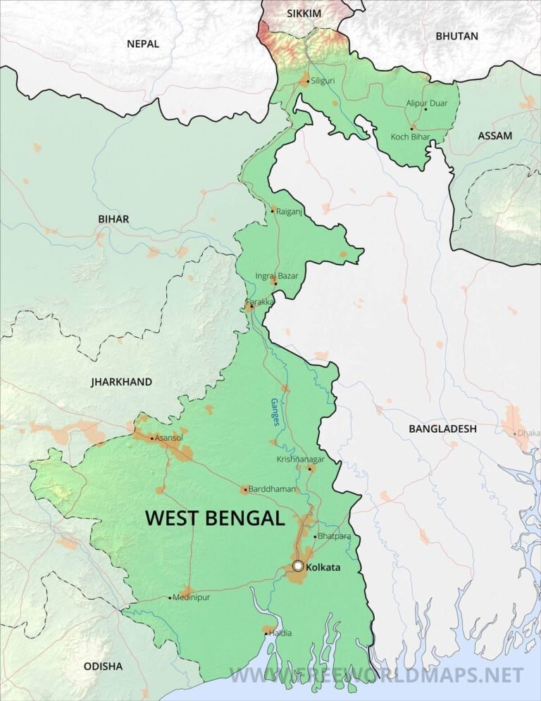
Geography of West Bengal:-
West Bengal, is the home of World’s busiest cantilever bridge and it also has produced “5 Nobel Laureates” which are Sir Roland Ross, Rabindranath Tagore, C.V. Raman, Amritha Sen and Mother Teresa. It is also home to the Worlds largest Banyan Tree in Botanical Garden of Kolkata and also has India’s Oldest Port the “Port of Kolkata” built in 1870.
The state of West Bengal is 18th Largest state in terms of Area with the total area of 88,752 Sq. km. The state shares its border with many states which are, Bihar, Jharkhand, Odisha, Assam and shares its border with country of Bangladesh.
The state is divided into four physiographic regions, which are:-
- Northen Mountains or Darjeeling Range
- Western Plateau
- Northern Plains
- Southern Plains
The state has the average elevation of 500 metres (1,600ft), with its lowest point at 11 metres (36ft) and highest point at 3,636 metres (11,929ft), at the point of Sandakphu.
The Major Rivers of West Bengal are :-
- Barakar River
- Bhagirathi River
- Bhairab River
- Damodar River
- Ganga River
- Hooghly River
- Jalangi River
- Jaldhaka River
- Mahananda River
- Subarnarekha River
- Teesta River
- Torsa River
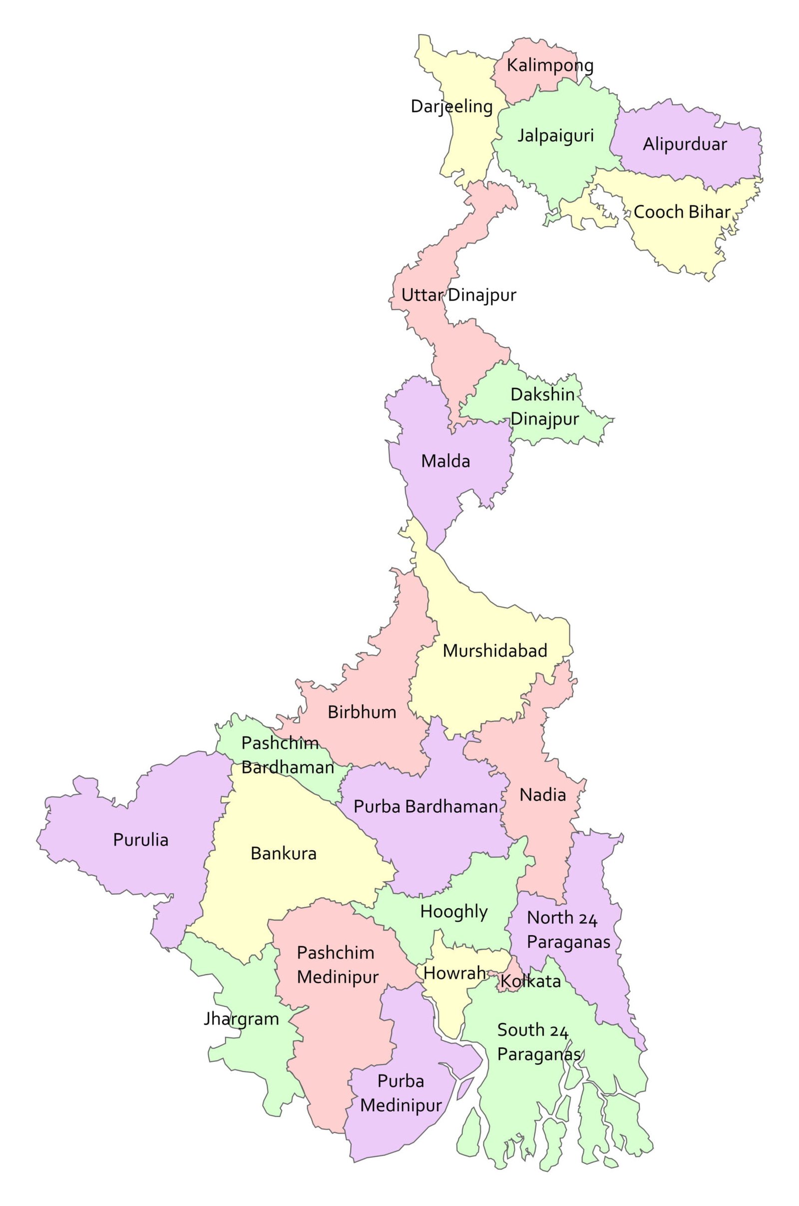
Districts of West Bengal (With Official Links):-
STATES:-
UNION TERRITORIES:-
| Andaman and Nicobar Island | Dada Nagar Haveli & Daman & Diu | Jammu & Kashmir | Lakshadweep |
| Chandigarh | The Government of NCT of Delhi | Ladakh | Puducherry |